The Beartooth Highway runs 68 miles along US Route 212 from Red Lodge, Montana to Cooke City, Montana, crossing a corner of Wyoming along the way. At Beartooth Pass, the road reaches 10,947 feet, making it one of the highest paved highways in the country. Most of the drive sits well above treeline, with wide alpine plateau on both sides and views stretching into Wyoming and back into Montana. Many people drive it as the approach to Yellowstone’s northeast entrance, but the highway is worth the trip on its own. Here is what you need to know before you make the drive.
What the Beartooth Highway Is
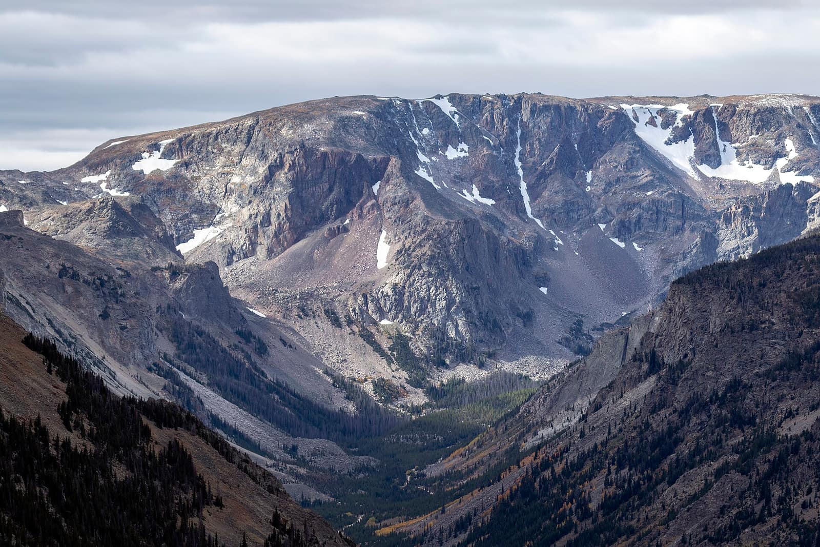
US Route 212 between Red Lodge and Cooke City is what everyone calls the Beartooth Highway. Red Lodge sits at roughly 5,550 feet in Carbon County, at the base of the eastern Beartooth Mountains. From there, the road climbs more than 5,000 feet over about 25 miles of hairpin switchbacks before leveling out on the high plateau near the pass. The plateau is wide and exposed, with granite outcrops, alpine lakes, and the kind of horizon that makes Montana’s scale obvious.
After crossing Beartooth Pass, the road descends into Wyoming through the Clarks Fork Valley before climbing back into Montana near Cooke City. The Custer Gallatin National Forest manages the road on the Montana side; the Shoshone National Forest handles the Wyoming section. There is no fee to drive the highway itself. A national park pass is only needed if you continue into Yellowstone from Cooke City.
When It Opens and Closes
Plan your whole itinerary around this. The Beartooth Highway is typically open from around Memorial Day weekend through mid-October, but snow can close it in any month, including July. In a heavy snow year, the opening slips well past the holiday weekend. In a light year, it opens closer to mid-May. The window at the end is equally variable: mid-October is the average close, but an early-season storm can shut it down weeks before that.
The Montana Department of Transportation posts current road status and closures at mdt.mt.gov/travinfo. Check it the day before and the morning of your drive, not just at the start of planning your trip. A closure adds most of a day to any detour, and there is no quick alternate route once you are committed to the Red Lodge side of the mountains. For the Wyoming section, wyoroad.info updates quickly when conditions change.
Late June through early September is the most reliable window for a clear pass. September brings smaller crowds and fall color on the lower slopes near Red Lodge. The larch and aspen in Carbon County turn in late September, and if the road is still open, it is genuinely worth the timing.
The Drive from Red Lodge to the Summit
Red Lodge is about 60 miles south of Billings on US-212, roughly one hour of direct driving. The town has gas, a grocery store, multiple restaurants, several hotels and motels, and Red Lodge Mountain for skiing in winter. Fill your tank here: services disappear fast once you start climbing.
From Red Lodge, the highway heads southwest and enters the Rock Creek canyon. The forest closes in for the first several miles, then the switchbacks begin and the trees give way to open alpine slopes. Rock Creek Vista overlook sits partway up the climb, with parking and a long view back down the canyon toward Red Lodge. This is one of the most useful stops on the whole drive for getting your bearings: you can see the hairpins below you and the plateau stretching ahead. On busy summer weekends, arrive early or expect a wait for a parking spot.
The road continues up through open tundra to the summit area. Plan the full drive from Red Lodge to Beartooth Pass to take one to two hours depending on how many times you stop. The high terrain is not forgiving: at 10,947 feet there is no shade, afternoon thunderstorms build fast over the plateau in July and August, and the UV exposure is serious. If you are sensitive to altitude, drink water and take the ascent slowly.
Near the Summit
The summit area of Beartooth Pass has a few pullouts with interpretive signs about the geology and ecology of the plateau. The Beartooths are some of the oldest exposed rock in North America, Precambrian granite and gneiss pushed up by uplift and scraped down by glaciation. What you see now is what was left.
On the Wyoming side of the pass, Beartooth Lake sits just off the highway with a Forest Service campground and a trailhead into the Beartooth Wilderness. Island Lake, a few miles further west, is another campground and a staging area for longer backcountry routes across the plateau. Both campgrounds sit above 9,000 feet, are first-come, first-served, and fill by early afternoon on peak summer weekends. Check availability at recreation.gov if you want to reserve a spot; some sites there have moved to a reservation system.
Clay Butte Lookout is accessible via a short dirt road off the main highway, roughly four miles east of Beartooth Lake. A 2-mile drive gets you to the trailhead; the fire lookout tower is at 9,811 feet and staffed seasonally. The view from the top takes in the full sweep of the Beartooth plateau to the north and the Absaroka Range to the south. It is a good side trip if you have an extra hour.
Mountain goats are routinely spotted on the rocky outcrops near the pass. Marmots are nearly guaranteed around any talus field. Pika, small relatives of the rabbit, live in the same terrain and are easiest to spot by listening for their sharp bark. Do not feed any wildlife; at this elevation, human food disrupts the metabolism of animals that are already marginal on calories for winter.
Hiking and Side Trips Along the Route
The Beartooth Wilderness holds more than 900 lakes and hundreds of miles of trail, most of it accessible only to those who leave the highway and walk in. Day hikers can get a taste from several trailheads directly on US-212. The Beartooth Lake trail loops around the lake in under two miles. Island Lake is a straightforward out-and-back of similar length, with the option to continue further into the wilderness if you have time and legs for it.
Longer routes cross the plateau connecting multiple lakes and can run several days for backpackers. No permit is required for overnight use in most of the Beartooth Wilderness, but campers should follow Leave No Trace practices, camp at least 200 feet from water and trail, and pack out everything. Conditions at this elevation stay winter-like through June: snow on the ground, frozen lakes, and cold nights. The main hiking window at high elevation is July through early September.
For hikers based on the Montana side, the Red Lodge Ranger District of the Custer Gallatin National Forest has current trail condition information, including which routes are still snow-covered. Contact them before planning a high-altitude trip, especially in June.
Driving to Cooke City and the Yellowstone Connection
From the summit plateau, the road descends through Wyoming’s Clarks Fork Valley and back into Montana near Cooke City. The descent on the Wyoming side is more gradual than the Red Lodge climb. Cooke City is a small community: a few blocks with gas, basic groceries, a handful of restaurants and motels. It is not a supply town in any meaningful sense. Stock up in Red Lodge before you start and arrive in Cooke City knowing you are not going to find much beyond the basics.
From Cooke City, Yellowstone National Park is 3 miles away at the northeast entrance. The road from the entrance into the park runs through the Lamar Valley, one of the best wildlife-watching corridors in the lower 48. Bison herds use the valley floor year-round. Wolf packs are active in the area and are spotted regularly by people who stop and scan with binoculars. Bears, pronghorn, and elk all use the valley at different seasons. If you are driving the Beartooth specifically to reach Yellowstone, plan to spend at least two hours in the Lamar before continuing deeper into the park.
The Beartooth fits naturally into the broader Yellowstone Country itinerary that covers Bozeman, Big Sky, and the south-central Montana high country. A practical loop from Bozeman: drive east on I-90 to Billings, south on US-212 to Red Lodge, over the Beartooth to Cooke City, into Yellowstone, exit through the north entrance at Gardiner, and return to Bozeman via Livingston on I-90. That covers the main sights with minimal backtracking and works as a five-to-seven day road trip.
Where to Base Yourself
Red Lodge is the natural base for the Montana end of the highway. It has a real small-town main street, restaurants that reflect local tastes rather than tourist menus, and lodging ranging from budget motels to historic inns. Prices are reasonable compared to resort towns. The town is in the foothills, so it stays cooler than Billings in summer and warmer than the pass, making it a good overnight if you want to drive the highway in the morning when the light and road traffic are both better.
Billings, an hour north on US-212, has a wider range of lodging and the Billings Logan International Airport (BIL) if you are flying in specifically for this route. Bozeman (BZN airport) is farther but connects to far more flights and is the standard base for Yellowstone and Big Sky country. From Bozeman to Red Lodge is about two hours: east on I-90 to Columbus, then south on MT-78.
For road-timing reference, see our best time to visit Montana overview, which covers seasons across the state, not just the pass window. If you are comparing this drive against Glacier, our Going-to-the-Sun Road guide covers the planning specifics for that route. For a rundown of other drives across the state, see Montana’s scenic drives and our picks for the best scenic drives in Montana.
Frequently Asked Questions
When does the Beartooth Highway open?
The typical opening is around Memorial Day weekend in late May, but it varies by year depending on snowpack. Heavy snow years push it into June. Check mdt.mt.gov/travinfo for current status before you plan the drive.
How long does it take to drive the Beartooth Highway?
The highway is 68 miles from Red Lodge to Cooke City. Without stops, figure about two hours. With stops at Rock Creek Vista, the summit area, and Beartooth Lake, plan three to four hours. Add more if you plan to hike.
Do I need four-wheel drive for the Beartooth Highway?
No. The highway is fully paved and manageable in any standard passenger vehicle when it is open. Ice and snow can be present near the summit early and late in the season, in which case the highway is typically closed rather than left open for unequipped drivers.
Can I drive the Beartooth Highway in an RV or with a trailer?
Yes, but the switchbacks on the Red Lodge side are tight and require attention in anything long. Most drivers of large rigs take it slowly and use pullouts to let faster traffic pass. Very long combinations may find some turns difficult.
Is there gas along the Beartooth Highway?
No. Fill up in Red Lodge before you start. The first fuel on the other end is in Cooke City, with limited availability. Do not count on Cooke City having a full-service station on any given day.