You Need a Rental Car
Montana has no intercity passenger rail serving the main travel corridors, no statewide bus network, and no ride-share coverage outside a handful of larger towns. If you are flying in, book a rental car at the same time you book your flight, especially for any trip between June and August. All four major airports, Bozeman Yellowstone International (BZN), Missoula (MSO), Glacier Park International in Kalispell (FCA), and Billings Logan International (BIL), have on-site rental desks for the major companies. Expect to pay roughly $80 to $180 per day for a standard SUV in peak summer. Rates in May and September typically drop to $50 to $100 per day for the same vehicle class. If you are visiting Glacier in July, book months ahead, not weeks. Rental availability at FCA and MSO gets thin fast, and last-minute rates can run well above the peak average.
Montana Is Bigger Than It Looks on the Map
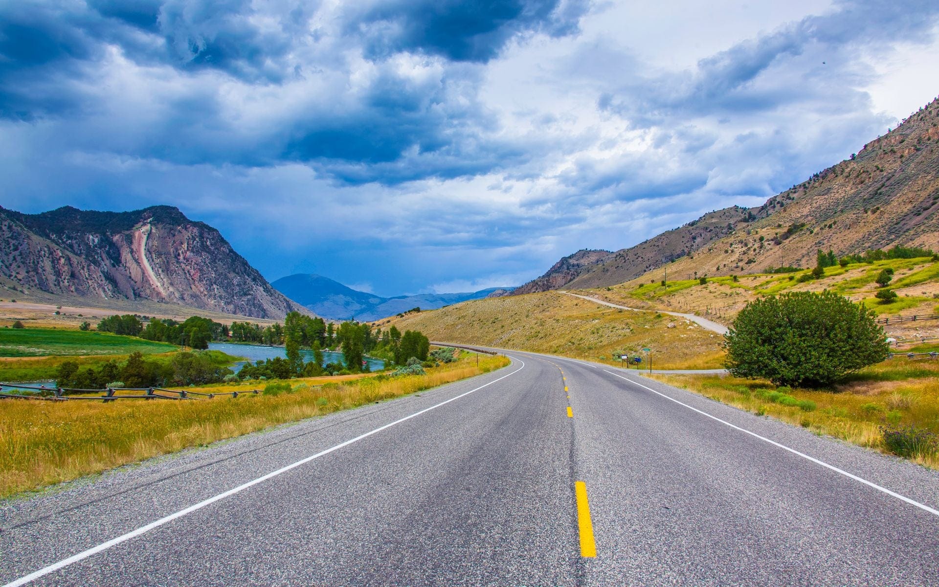
The most common planning mistake visitors make is reading a Montana map and not accounting for the actual scale. The state stretches roughly 600 miles east to west and 280 miles north to south, and there are no shortcuts between the major destinations. Bozeman to Glacier National Park is about 400 miles and takes 6 to 7 hours without serious stops, whether you go north on US-93 through Missoula or cut across on US-2 along the Hi-Line. Bozeman to the North Entrance at Gardiner is about 80 miles and closer to 1.5 hours. Billings to Glacier runs 7 to 8 hours. Missoula to the West Entrance of Glacier is roughly 120 miles and about 2 hours. Those numbers are for moving vehicles on open roads in good weather. Add time for gas, food, wildlife jams, and the road construction that appears on major Montana highways most summers.
If you are combining Glacier and Yellowstone on the same trip, plan a full driving day between them, not half a day. A direct drive from Whitefish south to Gardiner is close to 9 hours by the most direct route. The most scenic path runs US-93 south from the Flathead Valley to I-90, east through Missoula and Bozeman, then south on US-89 through Paradise Valley into Gardiner. Most people break that drive with an overnight in Bozeman or Livingston. For help deciding where to bed down along the way, see our guide to Where to Stay in Montana.
Picking the Right Airport and Car
BZN is the right choice if Yellowstone, Big Sky, or south-central Montana is your main destination. It has the most direct flights from the largest number of US cities, including non-stop service from Denver, Salt Lake City, Seattle, Dallas, and Chicago, with more routes added most summers. FCA handles the northwest and Glacier best. MSO is solid for Missoula-based itineraries or as an entry point to the Bitterroot Valley and the Blackfoot River corridor before you head north toward Glacier Country. BIL makes sense if you are focused on the Beartooth Highway, Little Bighorn Battlefield, or southeast Montana.
If your route runs naturally from south to north, or the reverse, consider a one-way rental. Flying into BZN and dropping the car at FCA is a clean arc for a Yellowstone-to-Glacier trip through the state. One-way drop fees vary by company and season but typically run $150 to $300 or more. That cost is often worth skipping a full day of backtracking. Book a vehicle with enough cargo room for your gear, since most trunk space fills fast with camping gear, ski equipment, or fishing rods. SUVs and crossovers are the most popular category in Montana and also the first to sell out, so reserve early regardless of which city you are departing from.
Roads to Know, and When They Close
Most driving happens on I-90 across the southern portion of the state and I-15 running north-south through Helena and Great Falls. US-93 runs the length of the Flathead Valley from Missoula to Whitefish. US-2 crosses the northern tier east to west and connects the Hi-Line towns to the Glacier area. US-89 through Paradise Valley between Livingston and Gardiner is one of the most-traveled roads in Montana and one of the better ones. Going-to-the-Sun Road, the 50-mile route over Logan Pass (6,646 feet) inside Glacier National Park, is the most dramatic road in the state. It opens fully in late June or early July, weather depending, and closes with snowfall, typically sometime in mid-October. Private vehicles longer than 21 feet or wider than 8 feet, including mirrors, are not permitted between Avalanche Creek and the Sun Point parking area, which covers the entire summit section of the road. If you are driving a large truck, camper, or vehicle with a trailer, plan to park at one of the lower trailheads and take the park shuttle.
The Beartooth Highway (US-212) between Red Lodge and Cooke City at the Northeast Entrance of Yellowstone climbs to 10,947 feet and earns its place as one of the best road drives in the country. It is also seasonal: it typically opens around Memorial Day weekend and closes in October, sometimes earlier if early snow arrives at the summit. If you are routing into Yellowstone from the northeast, always confirm the Beartooth is open before building your schedule around it. Check current road conditions at 511.mt.gov before any mountain pass drive. Passes in both Glacier and the ranges west of Bozeman can ice over even in early June, and the forecast in a valley town tells you almost nothing about what is happening at 7,000 feet.
Practical Tips for Driving Montana
Gas stations thin out quickly outside the larger towns. On US-2 east of Havre, through the Missouri Breaks, and across the eastern prairie, stretches of 50 to 70 miles between stations are normal. Fill up when you see a pump rather than waiting until the gauge is low. Carry a paper map or download offline maps in Google Maps or Gaia GPS before you leave cell range, because signal disappears on most rural highways, many forest roads, and inside both national parks. Do not count on real-time navigation apps once you leave the main Interstate corridors.
Montana interstate speed limits run 80 mph during daylight hours on I-90 and I-15. Two-lane roads through mountain canyons and across open range typically drop to 55 or 45. Watch for livestock on unfenced roads in the eastern and central portions of the state: collisions with cattle happen on rural routes and are almost always severe for the vehicle. Wildlife crossings are highest at dusk and dawn, and elk on US-89 through Paradise Valley are a particular hazard in September and October during the rut. Before your trip, check what conditions and road closures to expect at Best Time to Visit Montana. And before you pack the car, our What to Pack for Montana list covers the gear that most first-time visitors wish they had brought.
Frequently asked questions
Do I need a 4WD or AWD vehicle in Montana?
For summer travel on paved park roads and interstates, a standard sedan works fine. AWD or 4WD becomes useful if you plan to drive unpaved forest roads, campground access roads, or any backcountry route. For winter trips to Big Sky, Whitefish Mountain Resort, or roads near Glacier, AWD with all-season tires is strongly recommended. Some rural county roads in January and February are passable only with snow tires or chains. Chains are rarely required on main roads but are a practical backup if you are crossing mountain passes in May or October.
Can I take a train or bus to Montana?
Amtrak's Empire Builder runs along the northern tier of Montana, stopping in Havre, Shelby, Cut Bank, and a few other small towns. It does not serve Bozeman, Missoula, Billings, or any of the main Yellowstone or Glacier gateways. If your schedule aligns and you can build an itinerary around the northern stops, it is a scenic ride, but for most travelers the car rental is the only workable option. Greyhound serves a limited number of Montana cities along I-90 and I-15, though frequency and routing make it impractical for a park-focused trip. The Montana Travel Guide covers the full planning picture for first-time visitors.
How do I drive between Glacier and Yellowstone?
There is no direct transit. Most people drive. The most common route runs south on US-93 from the Flathead Valley, picks up I-90 east through Missoula and Bozeman, then heads south on US-89 through Paradise Valley into Gardiner. Budget 8 to 9 hours of driving time and plan an overnight stop. Bozeman and Livingston are both practical midpoints with good food and lodging options. A handful of private shuttle services operate between the two parks, but they are expensive, route-limited, and require advance booking. If you want to see both parks on one trip without back-and-forthing, a one-way car rental from FCA to BZN (or the reverse) is the cleanest approach.
Is there Uber or Lyft in Montana?
Ride-share operates in Bozeman and Missoula during peak hours and around downtown areas. Coverage is thin and wait times can be long, especially outside evenings and weekends. Whitefish runs a free trolley between downtown and Whitefish Mountain Resort during the winter season. In smaller towns like Gardiner, West Yellowstone, Livingston, and Kalispell, do not count on ride-share. If you need airport transfers and do not want to deal with a rental car on arrival day, most larger hotels and lodges near the airports can arrange shuttle pickup, but you will still need a car for any driving during the trip itself.