Why Visit Central Montana
Central Montana doesn't compete with Glacier for alpine scenery or Yellowstone for geothermal spectacle. What it offers is harder to find: distance, quiet, and landscape that puts American history in real context. This is where Lewis and Clark spent an unexpected 18 days portaging around five waterfalls on the Missouri River in 1805, and where the river still runs wide and cold through a sandstone canyon that looks much the same as it did then. Travelers planning their first Montana trip should check the Montana Travel Guide to get a sense of all six regions before deciding where to focus their days.
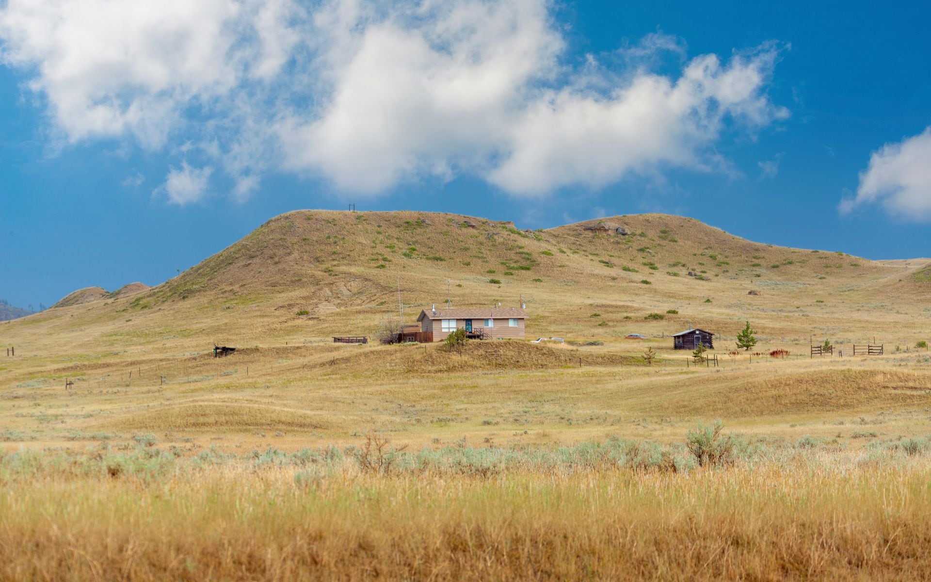
The Rocky Mountain Front is the defining geographic feature of the region. The mountains rise from the wheat plains without foothills, nearly vertical, with the Bob Marshall Wilderness complex running for more than 100 miles along the back side. On Highway 89 north of Choteau, that wall fills the entire western horizon. The towns in central Montana are matter-of-fact places that feed and supply the ranches, farms, and resource industries around them. That keeps prices reasonable and the tourist-to-local ratio sensibly low.
Top Places in Central Montana
Great Falls is the regional hub, Montana's third-largest city, and the practical entry point by air via Great Falls International Airport (GTF). The C.M. Russell Museum holds the largest public collection of works by Western artist Charles M. Russell and includes his original log-cabin studio. A few blocks away, the Lewis and Clark National Historic Trail Interpretive Center stands on the bluff above the Missouri River at the spot where the Corps of Discovery began their grueling portage around the Great Falls of the Missouri. It takes about two hours to do the interpretive center properly. For a meal before or after, Roadhouse Diner on 15th Street North does straightforward burgers and diner food and has earned over 2,000 reviews at 4.7 stars, which is a reliable signal in a city this size.
Fort Benton sits about 40 minutes north of Great Falls on US 87 and calls itself the Birthplace of Montana without much argument. The brick levee district along the Missouri still holds the bones of the fur-trade and steamboat era, and the Fort Benton State Historic Monument preserves the old fort walls beside the river. The Upper Missouri River Breaks National Monument begins just downstream from town, and multi-day float trips through the White Cliffs section of the Missouri are among the most remote and least crowded in the state. Fort Benton and places like it are exactly what we mean when we point people toward the Best Small Towns in Montana.
Lewistown occupies the geographic center of Montana, roughly 90 minutes east of Great Falls on US 87 through rolling wheat country. It sits in a high valley ringed by the Judith Mountains, Little Belt Mountains, and Big Snowy Mountains. Crystal Lake, up a gravel forest road in the Judith Mountains south of town, has short trails and cold, clear water worth an afternoon stop. The Charlie Russell Chew-Choo dinner train runs from Lewistown through the Judith Mountains from late May through September, a seasonal tourist train that covers some of the most remote ranch country in central Montana. Check current schedules and ticket prices before booking.
Choteau is a ranching town on the Rocky Mountain Front, about 90 miles northwest of Great Falls on US 89. It sits near Egg Mountain, a paleontologically significant site where researcher Jack Horner documented Maiasaura nesting colonies starting in the late 1970s. The Old Trail Museum in Choteau covers that fossil history in detail. The Teton River flows nearby, and trailheads into the Bob Marshall Wilderness complex are within about an hour west of town, giving the area genuine backcountry access without the crowds that build up around Glacier's trailheads.
Top Things to Do in Central Montana
Floating the Smith River is one of the most talked-about multi-day float trips in Montana and one of the most competitive permits in the state. The Smith runs roughly 59 miles through a limestone canyon with no road access once you're below the put-in at Camp Baker. Montana Fish, Wildlife and Parks manages a permit lottery for the season, which typically runs early May through mid-July. Applications open in January or February for the following season through the FWP website. Plan for four to five days on the water with full camping gear. The canyon walls, cold-water trout, and genuine isolation make it worth the planning effort, but don't count on landing a permit your first year of trying.
Freezout Lake Wildlife Management Area, near Choteau off US 89, is one of the most remarkable wildlife spectacles in Montana and almost nobody outside the birding world knows about it. Snow geese and tundra swans stage here during spring migration, with peak numbers arriving from late February through April. On a good day in March, you can watch tens of thousands of birds feeding and lifting off in waves, just off the highway with no hiking required. This is the kind of thing that makes serious wildlife watchers drive hours out of their way, and it happens well before the general tourist season begins.
The Kings Hill Scenic Byway, one of Montana's best scenic drives, follows US Highway 89 for about 70 miles through the Little Belt Mountains between Great Falls and White Sulphur Springs. Kings Hill Pass sits at 7,393 feet and the road passes through Lewis and Clark National Forest with trailheads for summer day hikes and snowmobile access in winter. Plan on two hours end-to-end if you stop at viewpoints. The byway is typically clear from late May through October, but check road conditions in spring, when the pass can hold snow into late May. The drive south connects to White Sulphur Springs and its natural hot spring pools.
Giant Springs State Park in Great Falls is worth a couple of hours. The springs here are among the largest freshwater springs in the United States, flowing at a constant water temperature year-round and supporting one of Montana's oldest fish hatcheries. The Roe River, running a few hundred feet from the spring outlet to the Missouri, was once listed in the Guinness World Records as the world's shortest river. The River's Edge Trail connects the park to downtown Great Falls, so you can extend a springs visit into a longer walk along the Missouri that passes the Great Falls of the river.
Where to Stay
Great Falls has the widest selection of lodging in the region, including national-brand hotels downtown and along the I-15 corridor. Mid-range rooms run an estimated $100 to $175 per night in summer, with rates lower in spring and fall. It's the most practical base if you're covering multiple central-Montana destinations in a single trip, since Fort Benton, Choteau, and the Kings Hill Byway are all within 90 minutes.
Lewistown has independently owned motels and a small downtown hotel that offer a quieter, more local stay. White Sulphur Springs, about an hour south of Great Falls on US 89, has natural hot spring accommodations where you can soak after a day on the Kings Hill Byway. Guest ranches near Augusta, at the base of the Rocky Mountain Front, offer all-inclusive packages with trail rides, guided fishing, and access to wilderness trailheads; rates typically run an estimated $200 to $350 per person per night depending on the operation and what's included. For a full breakdown of lodging options across all of Montana's regions, see Where to Stay in Montana.
Getting There and Around
Great Falls International Airport (GTF) serves central Montana with connections through Denver, Salt Lake City, and Seattle. It's a small airport with on-site rental car counters and a 10-minute drive to downtown. If you're starting your trip in Bozeman and working north, Bozeman Yellowstone International (BZN) is about 3 hours south of Great Falls via I-15 through Helena. Billings Logan International (BIL) is about 3 hours southeast via US 87 and works for travelers focused on the eastern parts of the region. Helena, the state capital over in Southwest Montana, is about 90 minutes south on I-15 and pairs naturally with a central-Montana loop. If you spend a night there, Windbag Saloon & Grill on Last Chance Gulch and Shellie's Country Cafe on Cedar Street are two well-reviewed local spots worth knowing about.
A rental car is the only practical way to move through central Montana, and our guide to getting around Montana lays out the distances before you commit to a route. The distances add up quickly: Fort Benton is 40 minutes from Great Falls, Lewistown is 90 minutes east, Choteau is 90 minutes northwest. US 89 is the main north-south artery through the region and connects the Rocky Mountain Front towns from Choteau south through White Sulphur Springs. US 87 runs east from Great Falls toward Lewistown and the Hi-Line country beyond. There is no meaningful public transit between these towns.
Best Time to Visit
Late May through September is the main travel window. The Kings Hill Byway clears by late May most years, the Smith River float season runs through mid-July, and summer days are warm without the extreme heat that builds up in lower-elevation parts of the state. Great Falls averages highs in the mid-80s Fahrenheit in July. Wildfire smoke can reduce visibility in August and September, though central Montana is somewhat less affected than the western valleys.
March is worth considering if birds are your primary reason for coming to the region; the Freezout Lake migration peaks well before the general tourist season begins, and the crowds around the area are essentially zero. Fall, particularly September through mid-October, brings cooler temperatures, the elk rut on the Rocky Mountain Front, and golden aspen in the Judith and Little Belt Mountains. Winter is cold and quiet: Great Falls averages January lows around 10 to 15 degrees Fahrenheit, and mountain roads including the Kings Hill Byway can be icy or closed from November through April.
Frequently asked questions
What is the best base for exploring central Montana?
Great Falls is the most practical base: it has the most hotel options, the main regional airport (GTF), and sits within 90 minutes of Fort Benton, Choteau, and the Kings Hill Byway. Lewistown works better if you're focused specifically on the Judith Mountains, the Charlie Russell Chew-Choo dinner train, or the Smith River put-in at Camp Baker.
How do I get a Smith River float permit?
Montana Fish, Wildlife and Parks runs a lottery for Smith River float permits, with applications typically opening in January or February through the FWP website. You apply online, select preferred launch dates, and wait for the lottery results. Competition is high; plan to apply in multiple consecutive years if you don't draw a permit the first time. The float season generally runs early May through mid-July.
Is central Montana worth visiting if I'm not going to a national park?
Yes, particularly for travelers interested in Lewis and Clark history, the Upper Missouri River Breaks, spring birding at Freezout Lake, or the Rocky Mountain Front landscape. Central Montana doesn't have a national park, but the Upper Missouri River Breaks National Monument protects a significant stretch of river corridor, and the Freezout Lake spring migration is a well-regarded wildlife event that happens right off the highway.
How far is central Montana from Glacier National Park?
Great Falls is about 2.5 hours south of the east side of Glacier National Park via US 89 through Choteau and Browning to the St. Mary or Two Medicine entrances. Choteau makes a natural overnight stop on a drive north to Glacier. The Montana Travel Guide has region maps and itinerary suggestions for combining central Montana with a Glacier visit.