Overview
Montana hiking spans five national forests, two national parks, several major wilderness areas, and millions of acres of BLM and state land. The range is real: you can spend an afternoon on a flat trail above Flathead Lake, drive to a Beartooth Plateau trailhead already above 10,000 feet, or spend two weeks traveling cross-country through the Bob Marshall Wilderness without crossing a road. Most out-of-state visitors focus on one of two main areas: Glacier National Park in the northwest corner, or the south-central ranges near Bozeman, Big Sky, and the north Yellowstone border. The Montana Travel Guide can help you decide which region fits your time and interests before you start booking.
Glacier gets the most attention, and the trail system backs it up. The park has more than 700 miles of maintained trail, and most trailheads sit within a short drive of Going-to-the-Sun Road, meaning you can start a serious alpine route without a long approach hike. The south-central part of the state, anchored by Bozeman and its Bozeman Yellowstone International Airport (BZN), puts you within reach of the Gallatin Range, the Bridger Mountains, the Absaroka-Beartooth Wilderness, and quick day trips to the Yellowstone border. These two regions are different enough in character that many visitors choose one as a primary focus and treat the other as a secondary stop if they have a full week or more.
What to Expect
Trail difficulty in Montana ranges from flat valley walks to sustained ridge routes that gain 3,000 feet or more. What stays consistent across most of western and south-central Montana is that you are hiking in bear country. Grizzly bears live throughout Glacier, the Bob Marshall Wilderness, the Beartooths, and the Gallatin and Absaroka ranges east of Yellowstone. Black bears are widespread across the rest of the state. Carry bear spray in an accessible hip holster on every outing, know how to pull and deploy it, make noise on the trail, and stay at least 100 yards from grizzlies and wolves. This is not remote-risk precaution; it is the standard operating procedure for hiking here.
The most-requested day hike in the state is Glacier's Highline Trail, which runs 11.8 miles from Logan Pass (elevation 6,647 feet) along the Garden Wall to the Granite Park Chalet. A connecting spur of about 4 miles drops from the chalet to the Loop trailhead on Going-to-the-Sun Road, letting you arrange a one-way shuttle rather than backtracking. Logan Pass is the starting point, and the parking lot there fills before 8 a.m. on most days from mid-July through late August. The far better move is to take the free Going-to-the-Sun Road shuttle, boarding at Apgar on the west side or St. Mary on the east. Snowfields linger on sections of the Highline route well into July, so pack trekking poles and consider microspikes if you are going in June or the first weeks of July.
The Many Glacier area, reached via US-89 through Babb on the east side of Glacier National Park, holds the highest concentration of trails per square mile in the park. The Grinnell Glacier Trail reaches active glacial ice in 7.6 miles round trip (from the boat shuttle drop-off across Swiftcurrent and Josephine lakes) or 11.2 miles round trip from the parking area at Many Glacier Hotel. Iceberg Lake is 9.7 miles round trip from the same trailhead and holds floating ice chunks well into August. Both require a timed vehicle reservation to drive into the Many Glacier valley during peak season, the same system as Going-to-the-Sun Road.
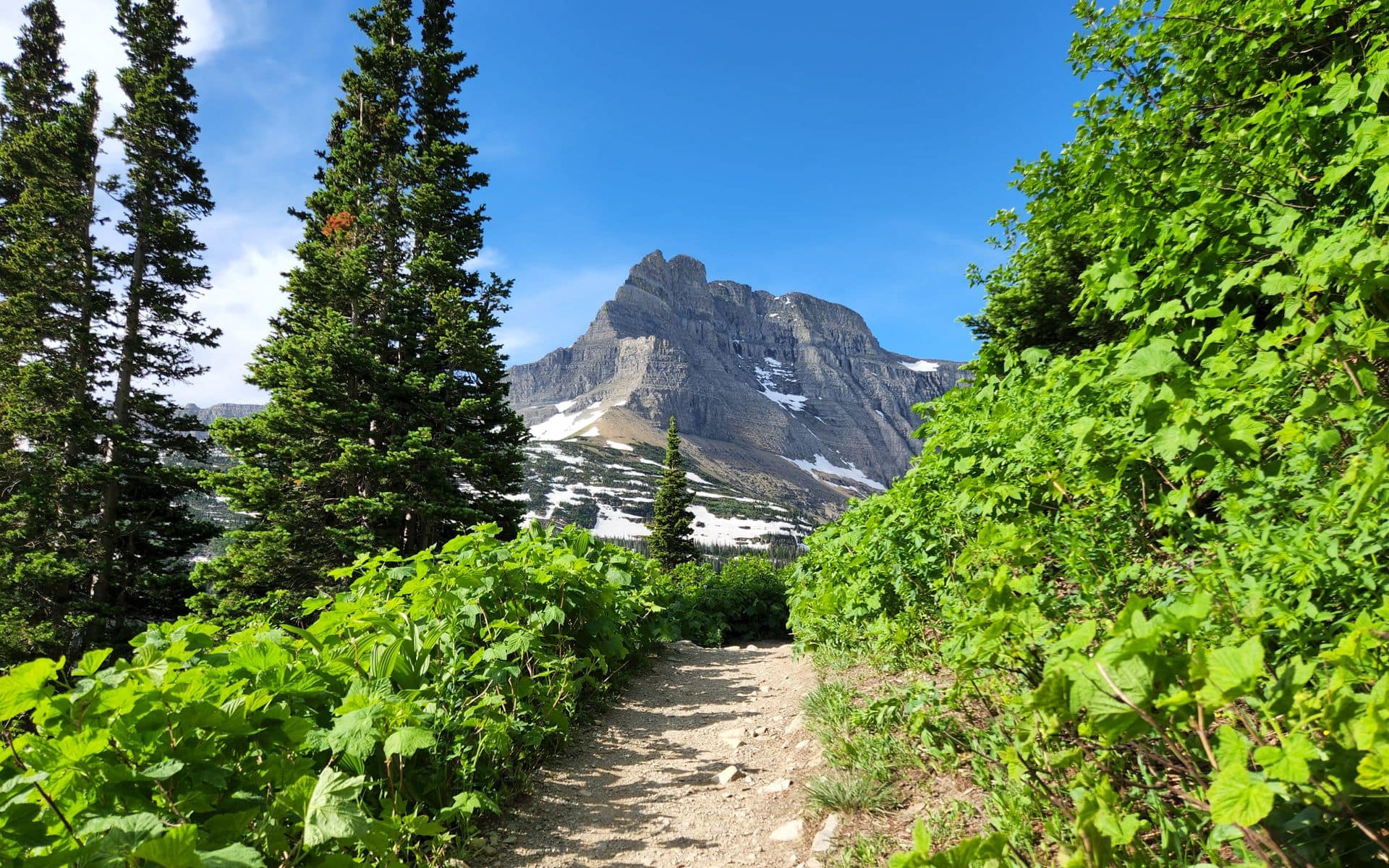
Outside Glacier, Beehive Basin near Big Sky is a standout that gets far less competition for trailhead parking than any Glacier route. The trailhead sits at the end of Beehive Basin Road, roughly 40 minutes south of Bozeman via US-191, and the hike is about 9 miles round trip with 1,600 feet of gain into a high-alpine cirque below Pioneer Peak. In late September the surrounding Spanish Peaks turn with early fall color and the crowds are a fraction of summer numbers. Hyalite Canyon, about 20 minutes south of downtown Bozeman via South 19th Avenue and Hyalite Canyon Road, offers multiple waterfall destinations on a trail system that stays passable most of the year, making it one of the few genuinely year-round hiking options in the state.
Best Season
The hiking season in Montana shifts dramatically by elevation. Valley trails around Missoula and Billings open as early as April and stay clear into November. High routes in Glacier and the Beartooths, many of which sit above 7,000 to 9,000 feet, don't reliably clear of snow until late June or early July, depending on the snowpack year.
The practical window for the state's signature alpine hikes runs from late June through mid-September. July and August are peak season: the days are long, most trailheads are fully accessible, and the wildflowers on the high passes are at their best. The trade-off is volume. Glacier's Going-to-the-Sun Road corridor and the Many Glacier area are legitimately crowded in July and August, and trailhead parking turns into a logistics problem if you arrive after 9 a.m. without a plan.
Mid-September into early October is worth considering if your schedule allows. Crowds thin noticeably after Labor Day. In late September, subalpine larch trees across Glacier's high country turn a sharp gold, a roughly two-week window that is one of the more specific and rewarding things you can time a Montana trip around. Temperatures drop into the 30s overnight at elevation by then, fresh snow on the passes is possible, and some high routes become slippery, but the trails themselves are often in better shape than they are in wet July.
Winter puts most of the high-elevation trail system out of reach, but snowshoeing and ski touring open different terrain for those willing to plan around it. Most winter visitors who want high-country time shift to lifts at Whitefish Mountain Resort or Big Sky Resort. See Skiing and Snowboarding for what Montana's winter mountains look like from that angle. Spring, roughly April through late May, is mud season at lower elevations and avalanche season higher up; it is the weakest window for hiking at any elevation.
Typical Costs
The biggest cost variable for Montana hiking is park access. The America the Beautiful annual pass costs $80 and covers entrance to both Glacier and Yellowstone, plus federal recreation sites nationwide. It pays for itself quickly if you spend more than a day at either park. Individual 7-day vehicle passes to Glacier run $35 per vehicle (estimate; check nps.gov for the current year's fee schedule). Yellowstone charges $35 per vehicle for a 7-day pass as well.
Backcountry camping in Glacier requires a permit: $7 per person per night plus a one-time trip reservation fee, booked through recreation.gov. Permits for high-demand zones, including campsites near Granite Park Chalet and along the North Circle route, fill within hours of the mid-March online lottery opening. Yellowstone backcountry permits are $25 per reservation and can be booked starting in April. For both parks, plan to sort permits months in advance if you have a fixed itinerary.
Guided day hikes with Montana outfitters typically run $100 to $200 per person (estimate range), often including transport from your hotel, snacks on the trail, and bear spray. Multi-day guided backpacking trips start around $300 to $500 per person per day (estimate), covering meals, equipment, and the outfitter's permit logistics. Prices vary by group size, trip length, and how remote the destination is. Browse Tour Operators and Guides to compare licensed operators serving the Glacier, Yellowstone, and Bozeman-area ranges.
How to Book
For independent hikers heading to Glacier, the main booking task is a timed vehicle reservation if you plan to drive Going-to-the-Sun Road or enter Many Glacier during the peak window, which typically runs from late May or early June through mid-September. The NPS adjusts the reservation system annually, so check glacier.nps.gov for the current year's rules before you go. Slots for the most popular dates open fast, often within minutes of the reservation window.
Glacier backcountry permits work on a two-phase system: an online lottery that opens in mid-March, followed by a walk-up window at park visitor centers starting in mid-May. If you miss the lottery, the walk-up system is workable with flexible dates. Show up at the Apgar or St. Mary Visitor Center by opening time, have a few target campsites in mind, and be willing to adjust your route to what is available.
For guided trips, book earlier than you think you need to. Montana's top hiking and backpacking outfitters fill their summer slots by February or March, especially for July and August dates near Glacier. Contact outfitters by January if you are targeting peak summer. Find licensed guides through Tour Operators and Guides, which lists operators by specialty and region.
Before booking anything, it helps to have a realistic itinerary. The 5 Days in Montana itinerary covers a practical cross-section of the state including hiking days, and it lays out the driving time between regions honestly. If you plan to combine hiking with time on a river, Fly Fishing in the Gallatin, Yellowstone, and Madison drainages pairs naturally with high-country hiking days in the same south-central region.
Frequently asked questions
Do I need bear spray for hiking in Montana?
Yes, and carry it where you can reach it in seconds: on a hip holster, not buried in a pack pocket. Grizzly bears live throughout Glacier, the Bob Marshall Wilderness, and the ranges near Bozeman and Yellowstone. Black bears are common across most of the rest of the state. Canisters are available to rent at Glacier and Yellowstone visitor centers and at most outdoor shops in Bozeman and Whitefish if you do not want to travel with one.
When does the Going-to-the-Sun Road open for the season?
The full 50-mile road from Apgar to St. Mary typically opens in late June or early July, with Logan Pass being the last section to clear each year. The NPS posts current status at glacier.nps.gov. Do not plan a Logan Pass trailhead hike without checking the current road status first; in high-snowpack years the road can stay closed through July 4th week or later. The shuttle service starts running before the full road opens, which can get you to some trailheads even when the road is not fully clear.
What are the best base towns for day hiking in Montana?
Whitefish and Columbia Falls put you 30 to 45 minutes from Glacier's west-side trailheads, and Whitefish has the best hotel and restaurant infrastructure in the area. Bozeman is the right base for the Gallatin Range, Hyalite Canyon, and the Bridger Mountains, with BZN airport making it the easiest place to fly into. For something closer to the park boundary, smaller towns like Gardiner (north Yellowstone) or West Yellowstone put you right at the trailhead without the drive. See Best Small Towns in Montana for a broader look at where to base across the state.
Is hiking in Montana suitable for families with young children?
Yes, with route selection. Hidden Lake Overlook in Glacier is 2.7 miles round trip from Logan Pass and runs mostly on boardwalk, making it one of the most accessible high-alpine hikes in the country for kids who can walk a few miles. Trout Lake in Glacier is an easy 1.2-mile round trip with lake access. Hyalite Canyon south of Bozeman has shorter waterfall trails that work well for younger hikers. Stick to well-traveled, signed routes with kids, start early to avoid afternoon heat, and carry bear spray regardless of how popular the trail is.