What to Expect
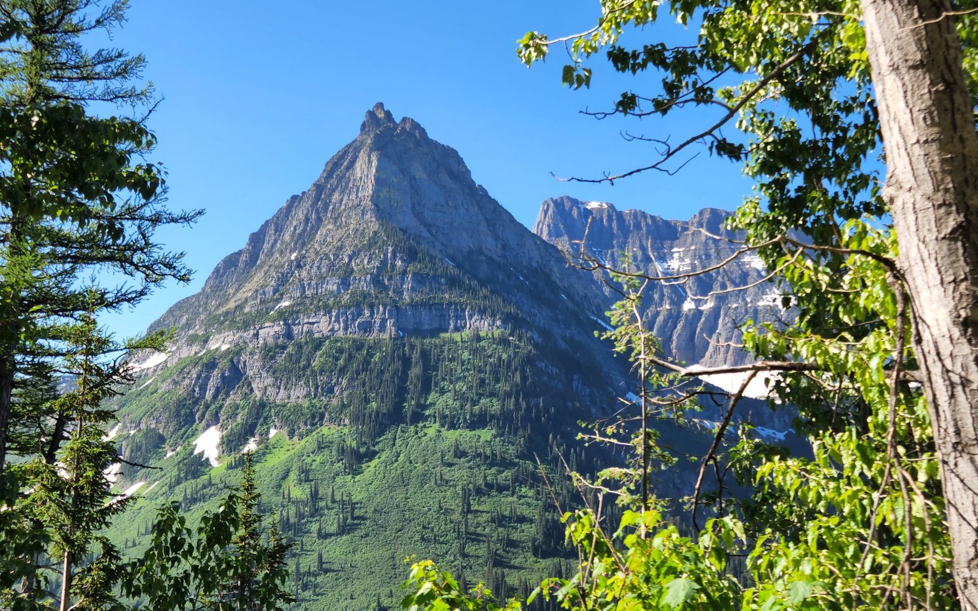
Glacier sits in the heart of Glacier Country, the northwest corner of Montana bounded by the Canadian border to the north and the Bob Marshall Wilderness to the south. The park holds more than 700 miles of maintained trail, 26 named glaciers, and two continental divide crossings. The dominant feature is Going-to-the-Sun Road, a 50-mile transmountain highway that runs from the west entrance at West Glacier through cedar forests above Lake McDonald, over Logan Pass at 6,646 feet, and down to the town of St. Mary on the east side. Nearly everything else in the park branches off from this road.
The Crown of the Continent designation applies to the larger ecosystem here: a mostly intact block of mountain habitat running through Montana, Idaho, and Alberta that still supports grizzly bears, wolves, wolverines, lynx, mountain goats, and moose. Glacier shares its northern border with Canada's Waterton Lakes National Park. This is grizzly country in a real sense, not a wildlife park where animals are contained, but a functioning wilderness where bears outnumber trail markers on some backcountry routes.
The park draws about 3 million visitors per year. Peak traffic runs from July 4 through Labor Day, with Logan Pass parking filling by 7 a.m. on busy days. Visiting on a weekday in late June or in September produces a noticeably different experience.
What to Do There
The Highline Trail is the signature hike. Starting at Logan Pass, it runs 11.8 miles one-way along the Garden Wall above Going-to-the-Sun Road to Granite Park Chalet, where you can catch the free park shuttle back. Most visitors go 4 or 5 miles out for the views and turn around. Bighorn sheep and mountain goats are common along this route, and grizzlies use the slopes above the trail regularly. This is the hike that defines Glacier for most people who have done it.
The Grinnell Glacier hike, at 10.6 miles round-trip from the Many Glacier trailhead, is the classic Glacier route. You pass three lakes and climb through wildflower meadows to reach what remains of Grinnell Glacier, which has lost more than 90 percent of its mass since 1966. The comparison photos at the overlook make that loss concrete. Iceberg Lake, 9.7 miles round-trip from the same trailhead, still holds floating ice chunks in late July and August.
Avalanche Lake is a 4.6-mile round-trip through old-growth cedar and hemlock to a narrow lake backed by waterfalls dropping off the cirque walls above. Hidden Lake Overlook, 2.7 miles round-trip from Logan Pass over a boardwalk trail, reaches an alpine lake above tree line. Mountain goats graze within 20 feet of the trail here in summer, which is unusual enough that first-time visitors stop walking entirely.
The Two Medicine area in the southeast corner gets a fraction of the Logan Pass traffic. Running Eagle Falls, called Trick Falls by locals because it flows through a hole in the limestone when water levels drop in late summer, is a 0.6-mile walk. Two Medicine Lake has paddle rentals and a short boat tour. The Many Glacier valley in the northeast is the best single spot in the park for grizzly watching, with open slopes above Swiftcurrent Lake that bears use for berry foraging from late July through September.
Boat tours run on Lake McDonald, St. Mary Lake, Two Medicine Lake, and Swiftcurrent Lake from roughly June through mid-September. The historic wooden boats on Lake McDonald have operated since the 1920s and are a Glacier institution. Tours run approximately $20 to $30 per adult (estimated current rates). Kayak and canoe rentals are also available at Apgar on Lake McDonald and at Two Medicine Lake.
Getting There and Parking
Glacier Park International Airport (FCA) in Kalispell is 35 miles from the west entrance at West Glacier and is the closest commercial airport with rental cars on site. The town of Whitefish, about 30 minutes from the west entrance on US-93, has more lodging options and better restaurants than West Glacier and makes a better multi-day base. Missoula (MSO) is 2.5 hours south on US-93 and a reasonable alternative with more flight options. From Bozeman (BZN), plan 6 to 7 hours of driving.
On the east side, US-89 north from Great Falls reaches the St. Mary entrance in about 2 hours. The town of East Glacier on US-2 serves the Two Medicine area and has the historic Glacier Park Lodge. Several small Montana towns along US-2 and US-89 make useful stops for gas and groceries before entering the park; there are no gas stations inside.
Going-to-the-Sun Road timed-entry vehicle permits are required from approximately mid-June through early September. Permits cost $2 per vehicle and go on sale months in advance at recreation.gov. They sell out quickly. After Labor Day, the requirement typically ends and you can drive without a reservation. Logan Pass parking fills by 7 a.m. on summer weekdays and earlier on weekends. The park's free shuttle connects West Glacier, Apgar, and Logan Pass and removes the parking problem entirely on the busiest days.
Park entry is $35 per vehicle for a 7-day pass (2025 estimate). An America the Beautiful annual pass at $80 covers entry and pays off in two national park visits. Fill up on gas in West Glacier, St. Mary, or East Glacier before entering the park.
Best Time to Go
July and August give you full access: the complete Going-to-the-Sun Road, all trails open, wildflowers in the high country from late June through early August, and reliable warm daytime temperatures in the 60s and 70s at valley elevation. The tradeoff is crowds, mandatory vehicle reservations, and trailhead parking that fills before sunrise.
Late June is worth targeting if your dates are flexible. The road typically opens somewhere between June 21 and July 4 depending on snowpack. In opening week, before the Independence Day crowds arrive, traffic is lighter and snowfields still line the slopes above Logan Pass. Check road status in advance through the NPS website because the timeline varies by several weeks from year to year.
September is the month experienced Glacier visitors recommend most consistently. Vehicle permit requirements usually end after Labor Day. Crowds drop off fast in the first two weeks of September. The larches in the high basins, particularly around the Sperry Glacier area and Grinnell basin, turn gold starting around late September. Grizzlies are active before denning, making wildlife viewing good through early October. Nights are cold but days are often clear and dry.
Winter closes most of the road network, but the park stays open. Cross-country skiing and snowshoeing are popular near the west entrance around Apgar, and snowmobiling is permitted on designated routes. Temperatures on the east side can drop below -20 degrees Fahrenheit during Arctic outflow events from Canada.
Good to Know
Bear spray is required practice, not an optional accessory. Glacier has one of the highest grizzly bear densities in the contiguous United States. Carry it in a hip holster where you can draw it in under three seconds, never buried in a daypack. Keep 100 yards of distance from bears and wolves and 25 yards from other wildlife including moose, elk, and bighorn sheep. Food storage rules apply in campgrounds and the backcountry.
Cell service is absent for most of the park, including long stretches of Going-to-the-Sun Road. Download offline maps before entering: the Avenza Maps app with the official Glacier NPS PDF map works without a signal, as does Gaia GPS once the map tiles are cached.
Campground reservations for the peak summer season open in March on recreation.gov and fill within hours for Many Glacier, Apgar, and Fish Creek. Many Glacier is the hardest to book because of its location in the best wildlife-watching corridor of the park. St. Mary and Two Medicine are somewhat easier to secure. Walk-up sites exist at most campgrounds but require arriving at or before 6 a.m. on busy days.
Glacier is about 30 to 35 miles from Flathead Lake, the largest natural freshwater lake west of the Mississippi. If you're based in Kalispell or Whitefish, a half-day on Flathead Lake fits naturally into a Glacier trip. Polson on the south end of the lake is about an hour from the west entrance, making it a reasonable detour on the drive out toward Missoula.
Frequently asked questions
Do you need reservations to drive Going-to-the-Sun Road?
During peak season, roughly mid-June through early September, yes. The NPS requires a $2 timed-entry vehicle permit to drive Going-to-the-Sun Road and access the Apgar Transit Hub during those dates. Permits go on sale months in advance at recreation.gov and sell out fast. After Labor Day, the requirement typically ends. Check the current year's rules before you book flights because the dates and the specific system have changed between seasons.
How long do you need in Glacier National Park?
Three full days gets you Going-to-the-Sun Road, two major hikes, and time in Many Glacier. Five or six days lets you cover Two Medicine, do an overnight in the backcountry, and explore both sides without feeling rushed. If you're connecting Glacier to Yellowstone or other parks on a longer trip, the National Parks guide covers how to sequence the parks efficiently.
Which entrance is best?
The west entrance at West Glacier is closest to FCA and connects to Lake McDonald, Avalanche Creek, and Logan Pass from the valley side. The east entrance at St. Mary is the better choice if you're coming from the Great Plains on US-89 or if you want to reach Many Glacier (another 10 miles north on US-89) without crossing the full park. The Two Medicine area uses its own entry road from East Glacier on US-2, separate from both main entrances. If you're driving from Billings or Bozeman through the east side of the state, plan to enter at St. Mary first.
Is it worth visiting if Going-to-the-Sun Road isn't fully open?
Yes, and the experience in the other areas is genuinely good. Many Glacier has the park's best hiking, including Grinnell Glacier and Iceberg Lake, and is not on Going-to-the-Sun Road. Two Medicine is independent as well and worth a full day. If the road opens partially from the west while Logan Pass is still snowbound, you can still reach Avalanche Creek and hike there without a vehicle permit.