What to Expect
Billings is a real working city of around 120,000 people, not a resort town, and that distinction matters for trip planning. The infrastructure works: Billings Logan International Airport (BIL) has direct connections from major hubs, every rental car agency has a counter there, and the hotel and restaurant range covers budgets from the Boothill Inn & Suites near the airport and the Best Western Plus Kelly Inn & Suites on the south side to the Northern Hotel, an independently run historic property on North Broadway. What sets Billings apart visually are the rimrocks, sandstone cliffs that rise roughly 400 feet above the north edge of the city and stay visible from almost anywhere on the main streets. The neighborhoods below them have hiking and walking trails that get you up top in under 20 minutes.
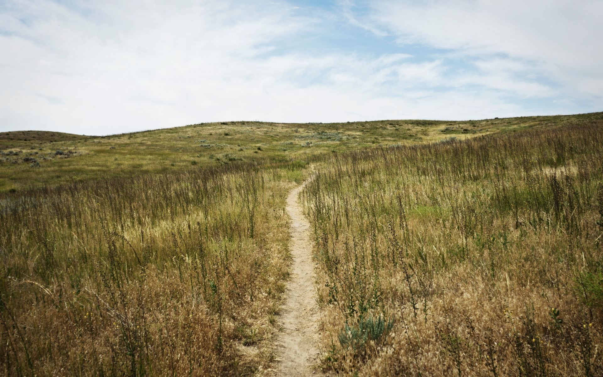
The Yellowstone River runs through the valley here. It's one of the longest undammed rivers in the lower 48, and the stretch near Billings is accessible for fly fishing and float trips on summer weekdays when the canyon is quiet. More practically, Billings sits at the crossroads for eastern Montana: about 65 miles southeast to Little Bighorn Battlefield, 60 miles south to Red Lodge and the base of the Beartooth Highway, and 140 miles east of Bozeman on I-90. If you're building a road trip through Southeast Montana, Billings is where most itineraries start and end.
What to Do There
Pompeys Pillar National Monument is about 28 miles east of Billings on US-312, and it's the most historically irreplaceable stop in the region. William Clark carved his name into the sandstone face on July 25, 1806, and that inscription is still there, the only on-site physical evidence of the Lewis and Clark Expedition that survives on the landscape. Nearly every other location along the 8,000-mile Corps of Discovery route has been built over or eroded. A short boardwalk trail climbs the butte; plan an hour and a half total. Admission runs around $7 per person (estimate; America the Beautiful pass accepted).
Pictograph Cave State Park sits five miles southeast of downtown, just off Coburn Road from I-90. The sheltered sandstone caves hold Native American pictographs dating back roughly 5,000 years, and the interpretive trail is short enough for kids. Most travelers heading toward Pompeys Pillar skip this entirely, which means it's uncrowded even in July. Combined with Pompeys Pillar, the two sites make a solid full-day outing east of the city.
Downtown Billings rewards a slow afternoon. The Yellowstone Art Museum on 27th Street runs serious rotating exhibitions alongside a permanent collection that leans heavily on Montana and regional artists, Charlie Russell included. The Western Heritage Center on Montana Avenue is free and covers the Yellowstone Valley's ranching and Indigenous history well. A few blocks of 1st Avenue North and Broadway hold an honest collection of breweries, coffee shops, and locally owned restaurants that outperform expectations for a plains city this size. Carverss Brazilian Steakhouse on 24th Street West runs a churrascaria-style tableside meat service with strong reviews; Montana's Rib & Chop House on towering Lane is the reliable call for ribs and steaks near the interstate hotels.
ZooMontana, on the southwest side of the city, is a small but well-maintained zoo with grizzly bears, mountain lions, wolves, and a botanical garden section. It's a genuine half-day for families with younger kids, and it stays far less crowded than the national park wildlife loops. Admission runs around $8-12 per person (estimate).
Getting There and Parking
Billings Logan International Airport (BIL) is the highest-traffic airport in Montana. Delta, United, American, and Alaska Airlines all fly in, with connections through Salt Lake City, Denver, Seattle, and Minneapolis-St. Paul. Round-trip fares from major East and West Coast metros typically run $350 to $600 or more (estimate; fares shift by season and booking window). Every major rental car agency has a desk at BIL. You need a car: there's no rideshare coverage beyond central Billings, and nothing that will get you to the rimrocks, Pompeys Pillar, or the Beartooth without your own wheels.
From the highway, Billings is on I-90. It's about 140 miles east of Bozeman (two hours), roughly 225 miles north of Cody, Wyoming via US-14/US-20 (about 3.5 hours through spectacular canyon country), and about 220 miles south of Lewistown through the heart of the plains. If you're combining Billings with Glacier National Park to the northwest, budget a full driving day: the most direct route runs west on I-90 to I-15 north through Helena, then up US-89 or US-2, totaling roughly 7 hours.
Parking downtown is easy. Most street parking is metered at low rates or free on evenings and weekends. The airport sits about 10 minutes northwest of downtown on US-87, with quick freeway access.
Best Time to Go
Late June through September is the main travel window. July and August bring the warmest temperatures, typically in the low to mid-80s Fahrenheit in town, with reliably low humidity and long evening light. Billings doesn't face the peak-season crowd pressure that Glacier and Yellowstone generate, so there are no timed-entry queues and campground lotteries here. The Beartooth Highway (US-212) south toward Red Lodge typically opens around Memorial Day weekend and closes with the first heavy snow, usually in October. If the Beartooth is on your list, aim for late June through mid-September.
Fall is a strong choice. September and October in Billings run warm by day and sharp by night, the rimrocks catch good low-angle light, and the crowds at Little Bighorn and Pompeys Pillar thin out noticeably. The elk rut peaks in late September across the hills south of town toward the Pryor Mountains. October road trips east toward Makoshika State Park in Glendive (about 220 miles east of Billings on I-94) are excellent in fall light.
Winter is cold. January averages hover in the low 20s Fahrenheit, with spells well below zero. But Billings gets notably less snow than western Montana cities, and downtown stays functional. Red Lodge Mountain ski area, 60 miles south on US-212, is a small locals-focused resort with day tickets that run significantly cheaper than Big Sky or Whitefish Mountain. Spring is windy and muddy, but the Yellowstone River corridor comes alive with waterfowl and shorebirds during migration in April and May.
Good to Know
Billings works best as a two to three night base. One full day covers Pompeys Pillar and Pictograph Cave to the east. A second day handles Little Bighorn Battlefield, about 65 miles southeast via I-90 to Exit 510 on the Crow Reservation. A third day is enough for a Beartooth run: drive south on US-212 to Red Lodge, then up the switchbacks to the pass summit at 10,947 feet, and back. If you're covering all three, plan three nights minimum.
Gas logistics matter east of Billings. Fill your tank in Billings before heading south on US-212 toward Red Lodge; the next option is Laurel, 15 miles out, or Red Lodge itself at 60 miles. Before heading east to Little Bighorn, note that Hardin (about 45 miles east on I-90) has reliable gas, but Crow Agency itself has limited services beyond the monument entrance. Cell service gets patchy on the Beartooth Highway above Red Lodge, and the pass summit corridor has essentially none.
If you're exploring Montana's best small towns in this corner of the state, Red Lodge deserves a stop beyond just the Beartooth. It's a mountain town with a walkable main street, solid food options, and the Bear Creek Saloon in the nearby community of Bear Creek, which runs pig races on summer weekend evenings. It's a Montana tradition that runs from Memorial Day through Labor Day and draws a genuinely local crowd. Hardin, closer to Little Bighorn, hosts the Little Bighorn Days reenactment each June, typically on the weekend nearest the June 25-26 battle anniversary.
Frequently asked questions
Is Billings worth visiting on its own, or is it mainly a base?
Both, depending on your interests. The rimrocks, downtown art museums, and Yellowstone Art Museum give you a genuine half-day to full day in the city itself. But Billings earns most of its appeal from what's within reach: Pompeys Pillar, Little Bighorn Battlefield, and the Beartooth Highway are all within a day trip, and none require an overnight outside the city. Treat Billings as your base and plan three nights to cover the main circuit comfortably.
How far is Billings from Yellowstone National Park?
The Gardiner (North) entrance to Yellowstone is about 220 miles south-southwest of Billings, roughly 3.5 hours via I-90 west and US-89 south through the Paradise Valley. The Cooke City/Northeast entrance is closer to 5 hours via US-212 over the Beartooth Highway, which is only open from roughly Memorial Day through October. West Yellowstone is about 5 hours to the west. Most travelers use Bozeman, Gardiner, or West Yellowstone as their Yellowstone base and plan Billings as a separate leg of the trip, not a same-day drive.
What is the Beartooth Highway and how difficult is it to drive?
The Beartooth Highway (US-212) runs about 68 miles between Red Lodge, Montana and Cooke City near Yellowstone's northeast entrance. It climbs to 10,947 feet at Beartooth Pass via switchbacks and exposed ridge driving. A standard passenger car handles it fine in good conditions, but weather changes fast: afternoon thunderstorms are common in July and August, snow squalls can happen any month at elevation, and the road sometimes closes temporarily after rockslides. Check road conditions through the Wyoming DOT site before you go. From Red Lodge to the pass summit is about 45 minutes; the full drive to Cooke City and back takes three to four hours.
What makes Pompeys Pillar different from other Lewis and Clark sites?
Most locations along the Lewis and Clark Expedition route have been built over, farmed, or eroded beyond recognition. Pompeys Pillar is the single exception: William Clark carved his name and the date (July 25, 1806) directly into the sandstone, and that original inscription is still legible. There's a protective glass cover over it now, but the carving itself is real and on-site. For anyone following the Corps of Discovery route across Montana, it's the most tangible stop on the entire trail.